Thursday, 11 October 2012

The Amazing Journey from Puno to Cusco

This is one of South America's most amazing trips - a bus journey, or should I say a coach journey for the Brits, through the Andes from Puno to Cusco.  It takes about 8 hours and is just a fantastic journey.  But have you tried taking photos through a coach window?  It just doesn't work, but here are some taken on various stops.
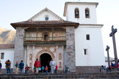
This is the church of Andahuaylillas.
Isn't this a lovely house there?

And another one
This is a lovely church in Pukara.
And this is opposite.
We continue on our way and pass La Raya.

And then we go on to Sicuani:

Sorry about the quality of these last photos.  Sometimes it's difficult taking photos from a bus.

Then we make our way to Cusco.

Saturday, 6 October 2012

We're off to the Colca Canyon

Colca Canyon, one of the two deepest in :Peru, is famous for sighting the condor.
What a beautiful bird!  This is what the National Geographic Society says about them:

"Andean condors are massive birds, among the largest in the world that are able to fly. Because they are so heavy (up to 33 pounds/15 kilograms), even their enormous 10-foot (3-meter) wingspan needs some help to keep them aloft. For that reason, these birds prefer to live in windy areas where they can glide on air currents with little effort. Andean condors are found in mountainous regions, as their name suggests, but also live near coasts replete with ocean breezes and even deserts that feature strong thermal air currents.
"These condors are mostly black, but males have a distinctive white "collar" around their necks and some white markings on their wings as well. Like their relatives, the California condors, Andean condors have bald heads.
"Condors are vultures, so they keep their sharp eyes peeled for the carrion that makes up most of their diet. They prefer to feast on large animals, wild or domestic, and in picking the carcasses, they perform an important function as a natural clean-up crew. Along the coasts, condors will feed on dead marine animals like seals or fish. These birds do not have sharp predator's claws, but they will raid birds' nests for eggs or even young hatchlings.
"These long-lived birds have survived over 75 years in captivity, but they reproduce slowly. A mating pair produces only a single offspring every other year, and both parents must care for their young for a full year.
"The Andean condor is considered endangered but is in far better shape than its California cousin. Perhaps a few thousand South American birds survive, and reintroduction programs are working to supplement that number."
There are actually 14 towns throughout the length of the valley and they have kept their religious festivities and folk art and music, so there is plenty to see there if you go at the right time.  Our new website will give more details.  the surrounding landscape includes the Hualca-Hualca, Ampato and Sabancaya volcanoes.
Here are another couple of views of the valley:

And then there's this:
Here's a view of the Ampato volcano:
And here's the Sabancayo:
Colca Canyon is 11,154 feet deep and is just an amazing experience.

Thursday, 4 October 2012

Arequipa - the white city and the majestic Misti

Now we're off to the White City of Arequipa.
This is Yanahuara and the Misti volcano and is taken from "el mirador e iglesia de Yanahuara", a popular spot where tourists gather to view the city and its background volcanoes.  The Yanahuara District is famous for its buildings built from sillar, a pearly white volcanic rock.
One of the main attractions of Arequipa is the Santa Catalina Convent:
and these:


It's often called a city within a city and was founded in 1580 for cloistered nuns.  It opened to the public in 1970, so it's become very well known.  This is the main square
Here's a church in the famous white stone:
This is Compañia Church:
And an Arequipa woman:
Another attraction is the Lady of Ampato or the Juanita Mummy, the mummy of a teenager who was offered as a sacrifice to the gods and can now be seen at the Andean Sanctuaries Museum at the Santa Maria Catholic University.

Here's Misti in all its grandeur:
This has been another fantastic day.

Today The Church of Jesus Christ of Latter-day Saints announced that they are to build their third temple in Peru at Arequipa. 

It will look something like this:

Wednesday, 3 October 2012

Postcard from Lake Titicaca


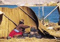
We have now arrived at the world's highest navigable lake - Lake Titicaca.  On the far shore is Bolivia and the Peruvians say that their side is Titi and the Bolivian side is Caca!  It's 12,500 ft above sea level and covers a vast 3,205 square miles, of which 1,815 are in Peru.  We are staying in the city of Puno.  The picture shows a reed boat, somewhat larger than the ones used in the fishing village of Huanchaco north of Trujillo.
Above are children in Puno and these are weavers:
Not surprisingly, the lake, which is a National Reserve, is really popular with tourists and has a large variety of fish, birds and mammals, including  giant frogs.  Here's a vicuña:

The lake also has  floating islands made of reeds that are inhabited by the Uros, descendants of an ancient people, so the islands take their name from them.   There are also other islands that maintain their ancient social and farming systems: Taquile, Amantani and Suasi. This is Taquile:
This is the main square:
Still on Taquile:


And this is a Taquile Man:
This is also on Taquile:

Above is a Taquile weaver and this is a Uros woman:
I had always wanted to go to these islands - but they're really cold at night although you can get sunburnt during the day.

And now we go to the town of Sullistani to see the burial towers:
And again:
And then there's the temple of fertilty:


And here's a typical mask:
What a fantastic couple of days!

Friday, 28 September 2012

Postcard from Huaraz

In a couple of years it will no longer be possible to enter Machu Picchu, only to view it from a viewing platform, and it's becoming increasingly difficult to do the Inca Trail as it's getting very worn and it has to be preserved.  However, this area is equally beautiful and has very good trekking.
This is the city of Huaraz, which is situated in the Cordillera Blanca mountain range in central Peru. It has a population of approximately 100,000 and is the capital of the Ancash region. Huaraz is situated at an altitude of 9,000ft in the Andes, about 280 miles north of Lima, and we're using it as our centre for exploring the surrounding area.

Huaraz sits in the agriculturally important Callejon de Huaylas valley, at the foot of the aforementioned Cordillera Blanca mountain range, which includes Huascaran, the highest mountain in Peru at 22,334ft. Mount Everest has an altitude of 29,029 ft. Huascaran National Park is a popular destination for tourism and trekking in particular, and Huaraz is a frequent base for expeditions to the Cordilleras Blancas and Huayhuash. Tourists often come from Argentina, Italy, Switzerland, Israel, Germany, the UK and the United States.

There is trekking by foot, mules and packhorses or you can take a minibus into the mountains.  


Tourists normally go to the Colca Canyon to see the condors, but they can be seen here equally well.  There are also protected plant species such as the Puya Raimondi and the queñual tree.

This is the Puya Raimondi tree - above - and below are a couple of photos of a very popular destination, Lake Llanganuco.


Rather different from the Inca Baths in Cajamarca are the thermal springs of Monterrey:
Sorry it's rather blurred!
In the Callejon de Conchucos, south-east of Huaras, is the archaeological complex of Chavin de Huantar which consists of temples, tunnels, stone buildings and carvings.  This site was the most important ceremonial centre of the ancient Chavin culture (900BC to 200BC) and in one of its tunnels is the Lanzón, an impressive and fierce looking mythical figure over 14 feet tall.

This is engraved rock:
And here's a Chavin carved head
And this is the Lanzón:
The area's most demanding and impressive trek, which lasts for 8 days, starts at the town of Chiquian.

Here are some more photos:
This, above, is Pastoruri and below is the Rio Santa Valley:
And this is the White Mountain range.

The best time to come here is between May and September when skies are clear. The snowline starts at 15,000 ft and nights are cold at high altitude and cool in Huaraz and other towns.

As with elsewhere in the Andes, the area is rich in arts and crafts such as lambswool blankets from Chavín, Tarica pottery, wrought iron objects, embossed leather, baskets and ponchos.

As I said at the beginning of this post, it is getting increasingly difficult to go to Machu Picchu and to do the Inca Trail, so this area is a wonderful alternative.